Altamont Pass Rd.
- December 11th, 2009
- Write comment
Start: Greenville Rd., Livermore, Ca
Finish: Grant Line Rd., Livermore, Ca
Distance: 7.9 miles
Estimated Travel Time: 14 minutes

Description:
Altamont Pass Rd. is a great alternative to driving on I-580 from Livermore to Tracy. Winding it’s way through the Altamont Pass this road is part of the Lincoln Highway (the first trans-continental highway in America).

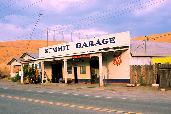
Still standing, the Summit Garage is a great historical landmark hinting to what the past was like in this area. While driving on Altamont Pass Rd. you should also take a moment to look around at the windmills that make this area unique. You will may also notice the railroad tracks that run along side of the road… ‘racing’ a train through the canyon is a blast!
Speed:
Like most roads with sweeping turns the speed limit doesn’t allow for too much fun, but it’s fast enough to not seem ‘slow’. During commute times it’s probably best to make sure you’re keeping thing under control.
Road Condition:
There are parts of this road that are currently under repair (stimulus money at work), but I think it’s actually made things bumpier… hopefully they repave the entire surface. For the most part though, the pavement is quite good.
Traffic:
This is an alternative to I-580 so traffic can be heavier during commute times.
Accessibility:
Running parallel to I-580 from Livermore to Tracy, Altamon Pass Rd. is very accessible. Once on the road there are no gas or food stops available.
Length:
Long enough to get into driving before having to change roads.


